
694x469-300x203.png)
LuGu Lake an amazing place to visit in China
Lugu Lake Overview🏞️
Lugu Lake is located at the border of Yanyuan County in Liangshan Prefecture, Sichuan Province, and Ninglang County in Yunnan Province, jointly governed by both provinces. The eastern side of the lake is under Lugu Lake Town (formerly Zuosuo District) in Yanyuan County, while the western side is in Yongning Township, Ninglang County.
The lake extends in a northwest-southeast direction, with a surface area of 50.1 square kilometers and a water volume of 2.252 billion cubic meters. Lugu Lake is a tectonic fault lake formed through dissolution and collapse, part of the Litang River system, a tributary of the Yalong River, which itself is a tributary of the Jinsha River, the upper reaches of the Yangtze.
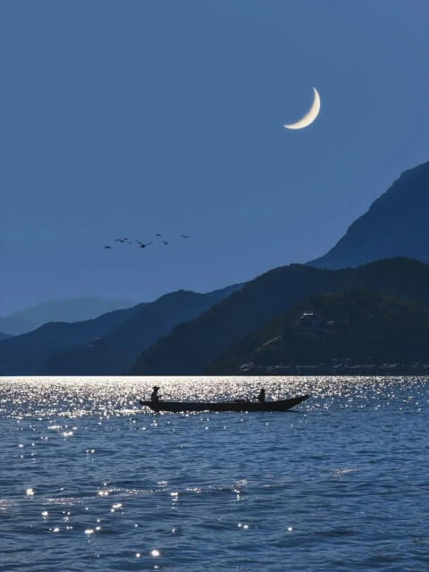
*Moonlit Lugu Lake.
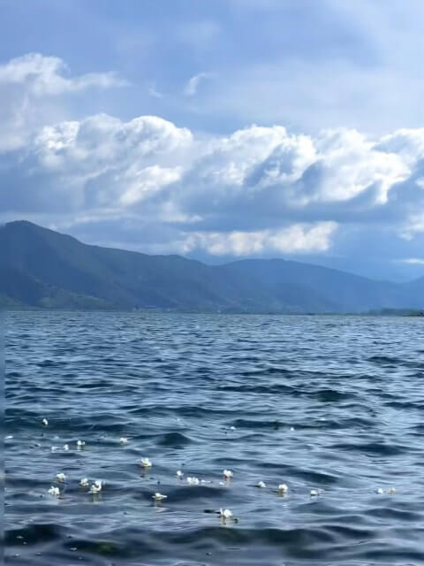
*Calm Surface of Lugu Lake.
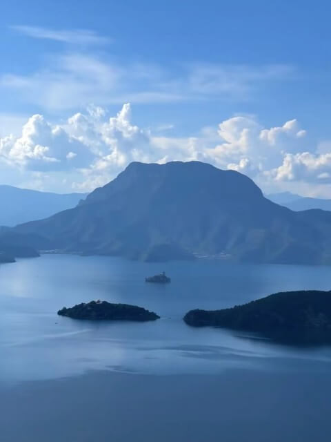
The lake basin lies in the Yongning Basin, making it China’s third-deepest freshwater lake, featuring a small island within. The surroundings are home to the Mosuo, Yi, and Pumi ethnic groups, with a total population of about 13,000 people, representing seven ethnic groups along the lake’s shores. The beautiful natural environment and unique cultural heritage make this a popular tourist destination. The area has been designated as the Lijiang Lugu Lake Mosuo Cultural Tourism Area and the Liangshan Lugu Lake Tourism Area.
In August 2023, efforts were underway to elevate Lugu Lake to a national 5A-level tourist attraction, and in December, the Sichuan portion of Lugu Lake was recognized as a key habitat for the black-necked crane, being listed as an important terrestrial wildlife habitat. A distinctive feature of Lugu Lake is a flower known as the “Water Lily,” which blooms between May and October. These delicate white flowers, with three transparent petals encircling a yellow center, are a notable sight across the lake’s surface.
Geographical Location🌏
Lugu Lake is China’s third-deepest freshwater lake, extending 9.5 km from north to south and 5.2 km from east to west, with a shoreline stretching about 44 km, of which 20 km are in Sichuan. The lake covers an area of 50.1 square kilometers, with 31.2 square kilometers belonging to Sichuan.
It has a catchment area of 247.6 square kilometers, 140.6 of which are in Sichuan. The lake’s maximum depth is 105.3 meters, and approximately half of the lake’s area exceeds 50 meters in depth, with an average depth of 40.3 meters. The water volume is 2.252 billion cubic meters, and the water’s maximum transparency reaches 12 meters, with a surface elevation of 2,690 meters.
Administratively, Lugu Lake is under the jurisdiction of both Yanyuan County in Sichuan and Ninglang County in Yunnan, with Sichuan overseeing 29.6 square kilometers (including 5.8 square kilometers of marshland) on the eastern side and Yunnan managing 27 square kilometers on the western side. The lake features five islands, four peninsulas, and a long island, with 14 bays.
The islands and peninsulas, typically 15 to 30 meters above the water, are surrounded by mountains, with Mount Gemu, also known as the Goddess Mountain, standing tall by the lake. Other formations, like Houlong Mountain, extend into the lake, giving Lugu Lake its distinctive horseshoe shape.
Geological Structure🌔
Geologically, Lugu Lake is part of the Hengduan Mountain fracture zone and the northern sloping area of the Kang-Tibet Plateau. Formed during the mid-Quaternary through tectonic movements and erosion, the lake is a high-altitude dissolution and fault lake basin. The region belongs to the Bayankala geosyncline zone and the Jinsha River fold system. The lake basin was shaped by faults and glacial activity, with cliffs and U-shaped valleys commonly seen around its periphery.
The rocky lake basin, deeply eroded, has more gradual slopes on the Sichuan side due to historical sediment deposits, while the mountains on the Yunnan side descend almost vertically into the lake. The karst formations and limestone cliffs surrounding the lake give rise to a diverse geological landscape.
Topographical Features🚩
Topographically, Lugu Lake belongs to the Hengduan Mountain range, characterized by deep valleys and high mountains. The lake’s winding shoreline forms small bays and harbors, dotted with seven islands, mainly limestone residual hills. Four major peninsulas extend into the lake, with the longest reaching four kilometers, effectively dividing the lake into a horseshoe shape. The eastern side features long, deep trenches, and steep slopes flank the northern and island sides.
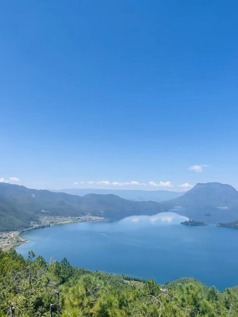
Mount Lion, standing at 3,754.7 meters, is to the north, while the dormant volcano Mount Xiao at 3,737 meters is to the northeast. To the southwest are the Dog Drill Hills at 3,400 meters, with the highest point being the peak near Yak Flats in the southwestern part, reaching 4,200 meters. The relative height difference creates a striking view, with Lugu Lake gleaming like a mirror amid the surrounding mountains.
*Surface of Lugu Lake.

*View from Lugu Lake.
Hydrological System🎊
Upstream Lugu Lake has 18 inflowing rivers, 11 from Yunnan and 7 from Sichuan, with nine being perennial. Among the largest inflows are the Shanqua River on the eastern shore and the Sanjia Village River from the south. Apart from these, the lake relies primarily on rainwater for replenishment. The basin receives an average annual rainfall of about 1,000 mm, with 89% concentrated between June and October.
ince the catchment area is not extensive, the inflowing streams are short, with rainwater and seasonal flow being the primary sources of water. Downstream The lake’s outflow is on the eastern side, draining through Caohai to Qiansuo River, then into Gaizu River (downstream called Yongning River), and finally to Wolong River, which connects to the Litang River, a tributary of the Jinsha River, flowing towards the Yangtze.
Climate Characteristics🌦️
The Lugu Lake area is influenced by the southwest monsoon and falls within a low-latitude high-altitude monsoon climate zone, featuring warm summers and mild winters. The lake’s presence moderates the local climate, resulting in minimal annual temperature variation.
The terrain creates a distinct microclimate, with temperatures decreasing as altitude increases. The region has marked wet and dry seasons, with the wet season from June to October and the dry season from November to May. The area enjoys abundant sunshine, averaging 2,260 hours per year, with a mean annual temperature of 12.8°C.
Biological Resources🦜
Flora Historically and according to surveys from 2010, the Lugu Lake basin has 784 species of seed plants across 378 genera and 114 families. The aquatic flora is notably diverse, with 42 species of vascular plants, including emergent, floating-leaved, and submerged species. Terrestrial plants include 104 families and approximately 650 species, with lush forests extending from the lake shore to the high-altitude areas.
Predominant trees are Yunnan pine, Lijiang spruce, and high-altitude oaks, along with various shrubs and grasses. Fauna The area is home to numerous bird species such as gulls, ducks, black-necked cranes, and swans. Mammals include monkeys, deer, and foxes, with amphibians like otters and frogs also present. In January 2024, two Baer’s pochards, a rare bird species, were observed for the first time in the lake area.
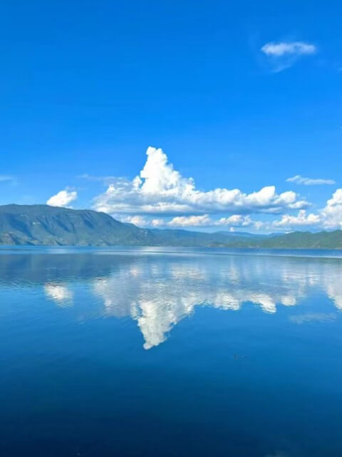
*Lugu Lake’s Mirror-like Calm Waters.
*High View of the Surface of Lugu Lake.
Ecological Protection💐
In 1986, the Yunnan Provincial Government approved the establishment of the Lugu Lake Provincial Nature Reserve. In 1999, the Liangshan Prefecture Government in Sichuan also established the Lugu Lake Prefecture-level Nature Reserve. The protected area encompasses Lugu Lake and the surrounding mountain ranges within the first ridge. The Yunnan Lugu Lake Wetland Reserve covers an area of 8,133 hectares and is designated as a provincial-level nature reserve.
The Sichuan Lugu Lake Wetland Reserve, which manages the eastern part of the lake and adjacent mountains, spans 16,867 hectares and is a prefecture-level nature reserve. This reserve is divided into three zones: a core area of 9,402.5 hectares (55.7%), a buffer zone of 1,746.5 hectares (10.4%), and an experimental area of 5,718 hectares (33.9%). The Sichuan Lugu Lake Wetland Reserve is located 118 kilometers from Yanyuan County, 262 kilometers from Xichang, and 92 kilometers from Ninglang County in Yunnan.
To effectively protect the ecological balance of Lugu Lake, efforts have been made to educate local fishermen on the importance of the fishing ban. In 2018, the region conducted a joint law enforcement operation between Sichuan and Yunnan provinces to enforce the ban. During this operation, 17 fish traps, 12 gillnets, 3 discarded nets, and 6 abandoned fish traps were confiscated from the lake, and 20 pounds of live fish were released back into the water.